We’re Fighting for the Cities We Deserve
Windsor-Essex Strong Towns is a group devoted to making Windsor-Essex County a better place to live. Join us on our mission to create a safer, more accessible Windsor-Essex.


HOW TO ADD A TREE TO
OPEN STREET MAP (OSM)

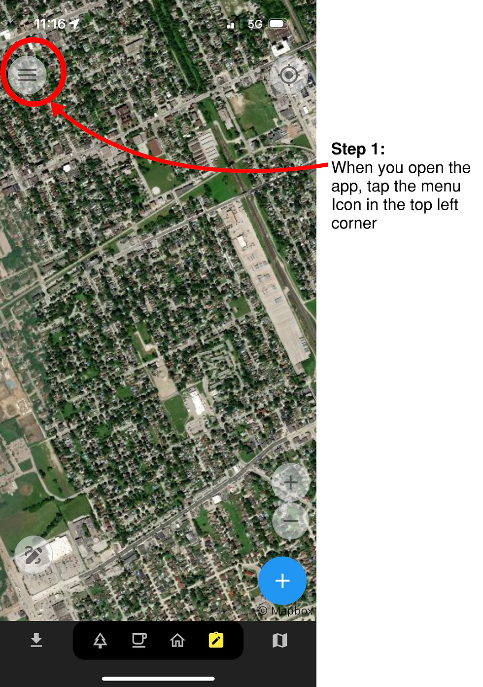
Step 1:
Go to www.openstreetmap.org and find the area where you want to add a tree.
If this is your first time using OSM, you will have to sign up for an account before you can edit the map.
When you return to the map, press the edit button to start editing.
Step 2:
The map may be overwhelming with all the information clutter. To fix this, click the “Map Data” icon (highlighted in orange), or press ‘U’ on your keyboard.


Step 3:
Scroll down to “Map Features”. This is all the different types of information currently being displayed on the map. Uncheck all except for “Points”.
“Points” are single objects displayed on the map such as trees, benches, vending machines, parking meters, etc..
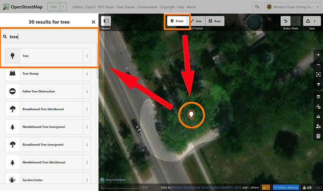
Step 4:
Now find a tree on the map that you’d like to add. When you’ve found the tree, click the “Point” button at the top of the screen, or press ‘1’ on your keyboard.
Next, click on the tree. Then, type the word tree in the search bar. Make sure that the point you just added to the map is selected when you search for the word “Tree”.
Finally, select the Tree option in the search menu. This will turn the point you just added into a tree.

Step 5:
After selecting tree, the menu on the left will change to show all the information for your point.
Fill in information that you know about the tree. When you’re done, click the submit button in the top right of the screen.
If the “Species” option is not shown, you can click the “Add Field” button and add species to the list.
Its ok if you don’t know any of the information. Only fill in information that you are 100% certain of.
Step 6:
You can just type “Added tree” in the box and then use “Local Knowledge” as the source
Finally, after clicking on the submit button, the menu on the left will change again.
Fill in the information about what you changed and click “Upload” when you’re done. It will turn blue once you’ve filled in the information.
**Note: You do not have to click on “Add Field”**

Congratulations!
You’re done!
You’ve just uploaded your first tree. Its important to note that you shouldn’t map based on satellite images. The satellite image you see on screen may be several years out of date and IS NOT RELIABLE.
Please only map trees that you’ve seen in person and know for certain are still there. Try going for a walk and noting all the trees in your neighborhood, or stick to a smaller area like a park.